Collection or topic
Maps
In this collection
15 records and collections
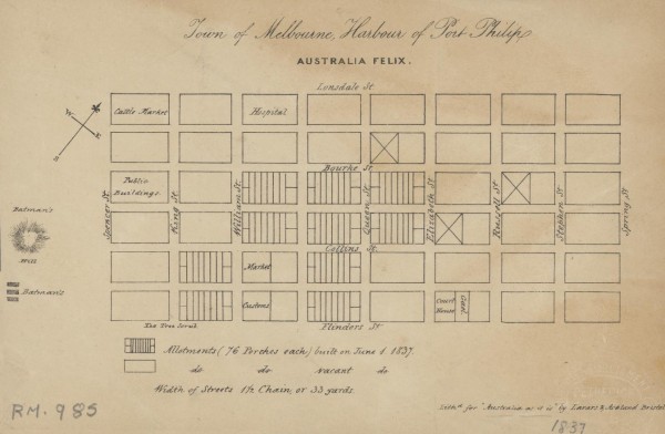
Map
1837 Town of Melbourne
1 of 14 next › last 1837 Town of Melbourne Open full image ↗ 1 of 14 next › last
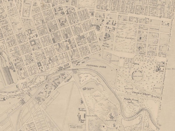
Map
1864 (revised 1875) East Melbourne Map
Extract of East Melbourne from British Admiralty Chart "Map of Hobson Bay and Yarra River leading to Melbourne" surveyed in 1864, first published 1865. This version has annotations dated 1875. See full chart under EMHS catalogue item emdf0041.
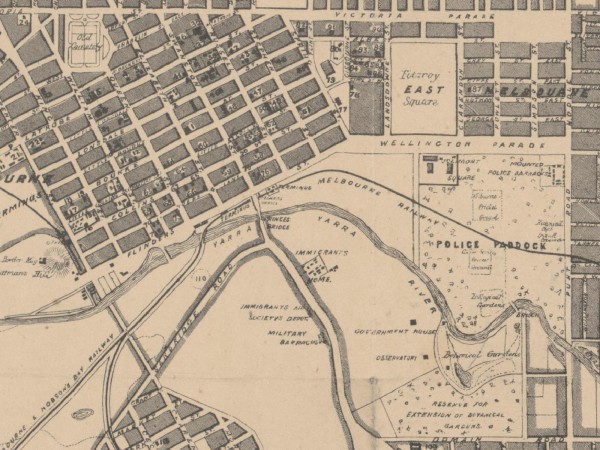
Map
1864c East Melbourne Map
first ‹ previous 3 of 14 next › last 1864c East Melbourne Map Open full image ↗ first ‹ previous 3 of 14 next › last
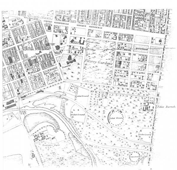
Map
1865c East Melbourne Map
first ‹ previous 4 of 14 next › last 1865c East Melbourne Map Open full image ↗ first ‹ previous 4 of 14 next › last
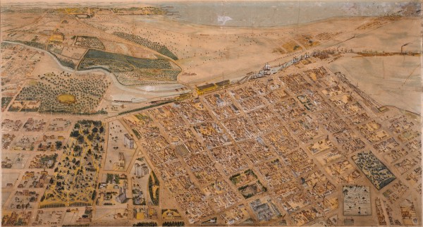
Map
1866 Isometrical plan of Melbourne & suburbs
Shows the layout of Melbourne streets circa 1866 with buildings, the Yarra, Port Phillip Bay in distance, parts of Collingwood and East Melbourne.
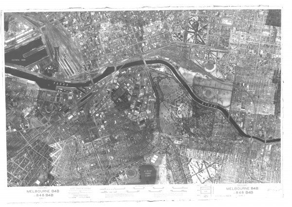
Map
1945 Aerial Photo - Melbourne
first ‹ previous 6 of 14 next › last 1945 Aerial Photo - Melbourne Open full image ↗ State Library of Victoria first ‹ previous 6 of 14 next › last
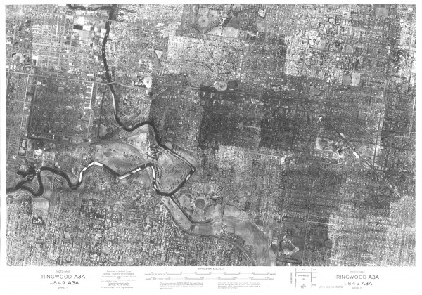
Map
1945 Aerial Photo - Melbourne East
first ‹ previous 7 of 14 next › last 1945 Aerial Photo - Melbourne East Open full image ↗ State Library of Victoria first ‹ previous 7 of 14 next › last
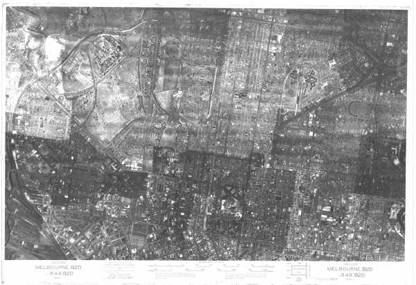
Map
1945 Aerial Photo - Melbourne North
first ‹ previous 8 of 14 next › last 1945 Aerial Photo - Melbourne North Open full image ↗ Acknowledgments State Library of Victoria first ‹ previous 8 of 14 next › last
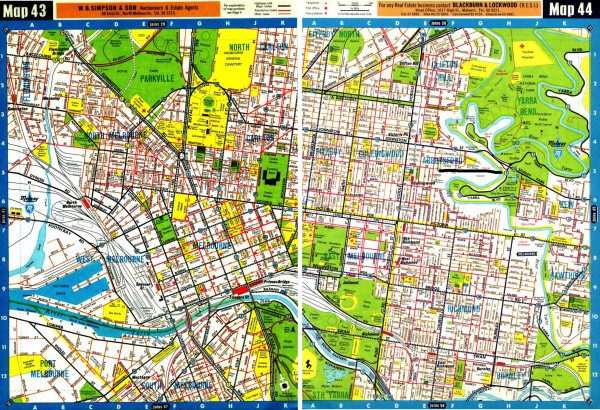
Map
1966 Melway Maps 043, 044
first ‹ previous 9 of 14 next › last 1966 Melway Maps 043, 044 Open full image ↗ Acknowledgments Maps Collection, State Library of Victoria first ‹ previous 9 of 14 next › last
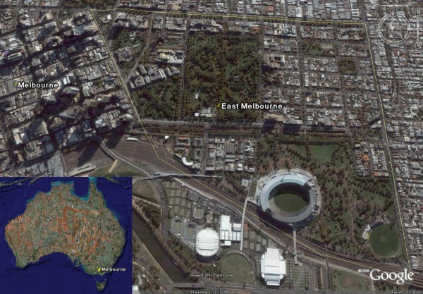
Map
2007 07 East Melbourne Google Earth
first ‹ previous 10 of 14 next › last 2007 07 East Melbourne Google Earth Open full image ↗ first ‹ previous 10 of 14 next › last
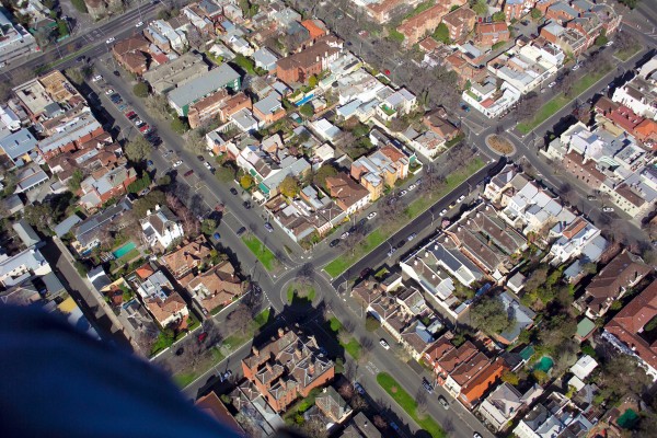
Map
2007 Aerial photo - Simpson & Hotham Streets
first ‹ previous 11 of 14 next › last 2007 Aerial photo - Simpson & Hotham Streets Open full image ↗ Photographer: John Bragagnolo. first ‹ previous 11 of 14 next › last
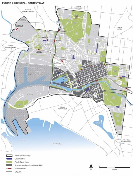
Map
2010 City of Melbourne MSS Figure 1 - Municipal Context Map
Figure 1 from City of Melbourne Municipal Strategic Statement July 2010. Click on the Zoom and pan tab to see the detail.
Map
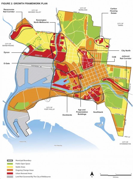
2010 City of Melbourne MSS Figure 2 - Growth Framework
first ‹ previous 13 of 14 next › last 2010 City of Melbourne MSS Figure 2 - Growth Framework Open full image ↗ Figure 2 from City of Melbourne Municipal Strategic Statement July 2010. See EMHS Catalogue Item DF0009 Acknowledgments http://www.melbourne.vic.gov.au first ‹ previous...
Map
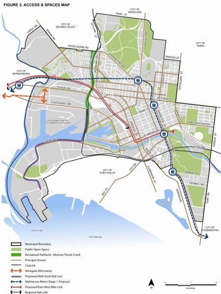
2010 City of Melbourne MSS Figure 3 - Access and Spaces Map
Figure 3 from City of Melbourne Municipal Strategic Statement July 2010. Click on the Zoom and pan tab to see the detail.
Collection item
City of Melbourne Municipal Strategic Statement (Amendment C162) July 2010
Amendment C162 to the City of Melbourne Municiple Strategic Statement. The proposal was released in July 2010 and is open for public submissions until 3 September 2010. From the City of Melbourne web site: Have your say on the new Municipal Strategic Statement (Amendment C162) Cr...