Collection or topic
East Melbourne Historical Society
This is a display of all images on the site.
Click on an image to go to the content page.
The Find function searches the content on the pages in which these images appear.
In this collection
1,761 records and collections
Collection item
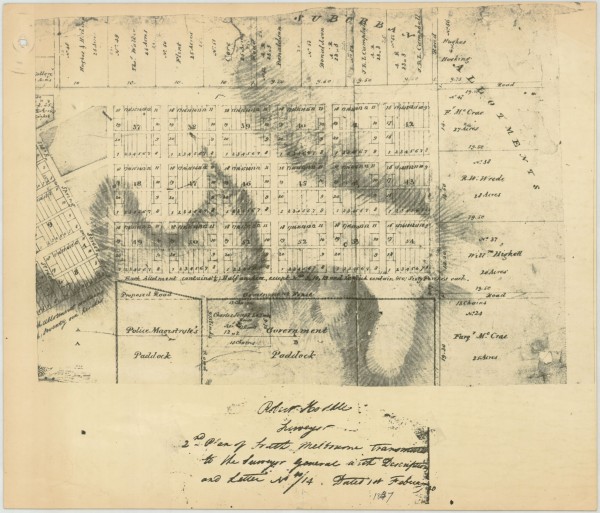
1837 East Melbourne Plan - Robert Hoddle
Part of Robert Hoddle's survey of South Melbourne completed in 1837 showing proposed roads and allotments. The location of La Trobe's house is shown but allotments are shown in the areas which later became Fitzroy Gardens and other public and church lands.
Collection item
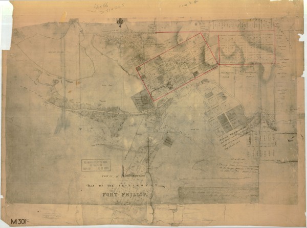
1837 Melbourne Plan - Robert Hoddle
Town of Melbourne, Plan of the Settlement of Port Phillip Includes planned allotments. Covers Melbourne, East Melbourne, South Melbourne, Yarra River and allotments along St Kilda Road.
Collection item
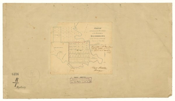
1843 Plan of Richmond by Robert Hoddle
The map shows Collingwood and Richmond subdivided into allotments. The Richmond allotments are inscribed with the names of the original purchasers. To the west of Richmond the part of East Melbourne south of Wellington Parade is shown. It is called Melbourne here as it was land t...
Collection item
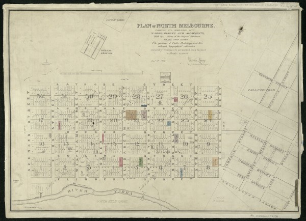
1847 Plan of North Melbourne by Charles Laing
The map shows the city of Melbourne with names of orginal purchasers marked. Public buildings are also marked. The western edge of the proposed East Melbourne is shown with streets marked with a set of names very different from the eventual names used. The map is in the collectio...
Collection item
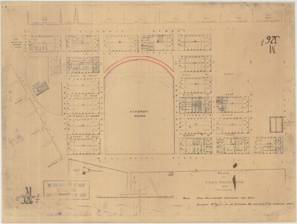
1848 East Melbourne Plan
Plan of East Melbourne 1848 Includes: Legislative Assembly on Spring Street opposite Bourke Street; Fitzroy Square (so named) showing some contemporary markings and plans, but not Treasury Gardens or Government Offices; Gisbourne Street running due north from Flinders Street to V...
Collection item
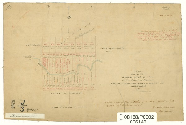
1848 Plan of Parish of Jika Jika
The map shows Richmond subdivided into allotments with names of first purchasers inscribed. To the west of Richmond lies the as yet undeveloped East Melbourne, south of Wellington Parade. The edge of the Government Paddock is shown. To the south-west of the paddock an arrow point...
Collection item
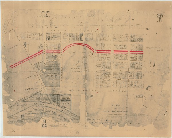
1850 East Melbourne Plan with later amendments
Plan of East Melbourne labelled 1850 but with various amendments dated 1862, 1863, 1864 and 1865 Significantly reworked from the 1848 plan. Includes: An extension of Bourke Street cutting through what was previously shown as the Legislative Assembly building to join up with Gisbo...
Collection item
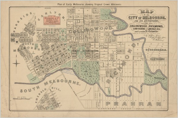
1852 Map of the City of Melbourne and its Extension - William Green
A map issued by O'Connor & Co., Land Agents. It is a copy of the original map drawn by William Green, surveyor, architect and land agent, in 1852 and released in December that year. The map covers the City of Melbourne and inner suburbs. It probably dates from the 1920s as by the...
Collection item
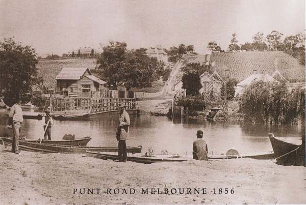
1856 - The punt at Punt Road
A photograph of the punt at Punt Road Richmond taken in 1856. The punt for horses and carriages is on the far (south) bank. There are several small punts for pedestrians on the north bank awaiting business. On the south side of the river Punt Road rises sharply with cultivated la...
Collection item
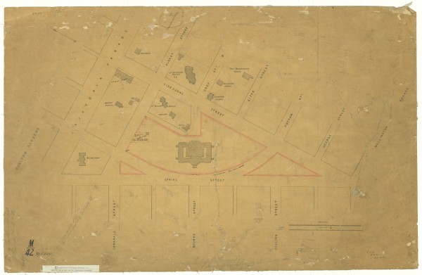
1856 Plan of Eastern Hill
Map shows Eastern Hill marked with churches and public buildings. The map shows some buildings which have been all but forgotten such as the Police Barracks, the Reservoir and Apsley Place. The original map is in the collection of the Public Record Office of Victoria, in its Hist...
Collection item
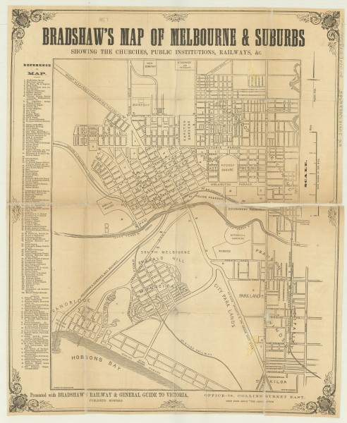
1857 Bradshaw's map of Melbourne & suburbs
A map of Melbourne and suburbs, with streets named and churches and public institutions marked. The original map is in the collection of the State Library of Victoria and its record reads as follows: Title: Bradshaw's map of Melbourne & suburbs [cartographic material] : showing t...
Collection item
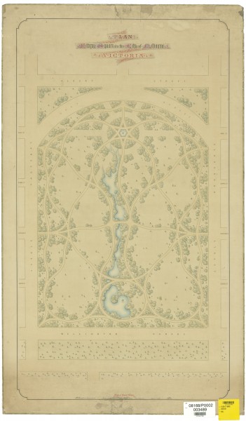
1857 Design for Fitzroy Square by E L Bateman
A plan showing the proposed design for the laying out of the Fitzroy Gardens by Edward La Trobe Bateman. The plan was commissioned by the City of Melbourne. The Age of 1 Jun 1858 reported on a Council meeting the previous day in which it was agreed, after some debate, to pay Bate...
Collection item
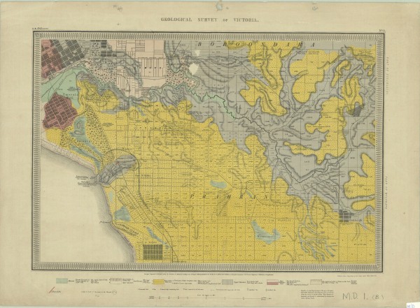
1859 Geological Survey Map
The map shows the central city grid and suburbs to the south and east, including East Melbourne. The caption beneath the map reads 'Surveyed, Engraved & Published under the direction of Alfred R C Selwyn, Govt Geologist'. As well as geological information the map provides physica...
Collection item
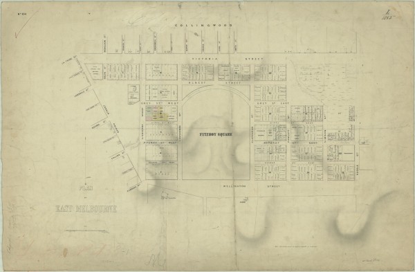
1859 Plan of East Melbourne
A map of East Melbourne showing original purchasers' names, land granted to churches, land reserved for public use. Capt Lonsdale's house is shown, as is Latrobe's Jolimont. It shows an early scheme for the Fitzroy Gardens and old street names such as Fitzroy Street for Hotham St...
Collection item
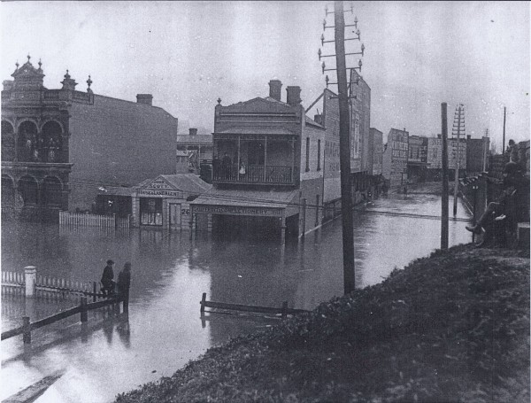
1891 Punt Road - Yarra in Flood
Two photographs presumed to be taken on 1 August 1891 when the Yarra River flooded to a near record extent causing severe damage to houses and property in Richmond and elsewhere. The location of both photos is at the railway bridge over Punt Road near Swan Street.
Collection item
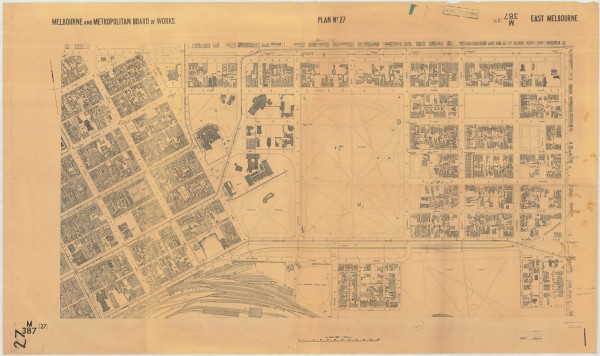
1894 East Melbourne Plan MMBW
MMBW Plan of East Melbourne lithograph dated 19 September 1894
Collection item
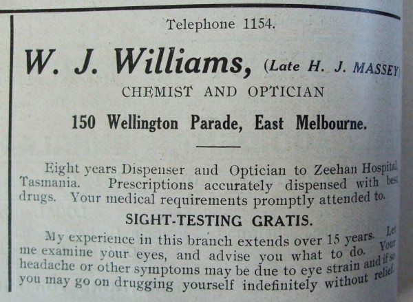
1912 Advertisement for W.J. Williams Chemist and Optician
Advertisement in the Church of England Messenger 2 February 1912 for W.J. Williams, chemist and optician, offering "prescriptions accurately dispensed" and "sight-testing gratis".
Collection item
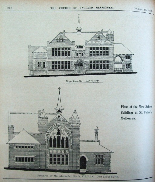
1912 Plans for new school buildings St Peters East Melbourne
Plans published in the Church of England Messsenger 25 October 1912 for a new school building at St Peter's Eastern Hill. The plans were drawn up by Mr Alexander North F.R.V.I.A. Cost projected at £5,700. The plans did not proceed.
Collection item
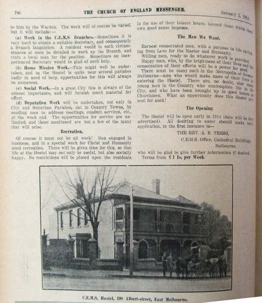
1914 Church of England Men's Society Hostel, East Melbourne
Photo of Church of England Men's Society hostel at 198 Albert Street published in the Church of England Messenger on 2 January 1914. The building is no more but the photo is readily reconciled with the building footprint outlined on the 1899 MMBW plan http://emhs.org.au/catalogue...
Collection item
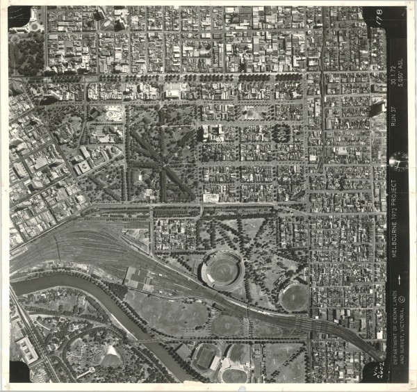
1972 East Melbourne Aerial Photo
Aerial photograph of East Melbourne taken at 12:48pm on 30 January 1972 from an altitude of 5,050 feet above sea level. Run 37. Centre of map approx corner of Wellington Parade and Clarendon Street. Central coverage: East Melbourne, Jolimont, Fitzroy and Treasury Gardens, Yarra P...
Collection item
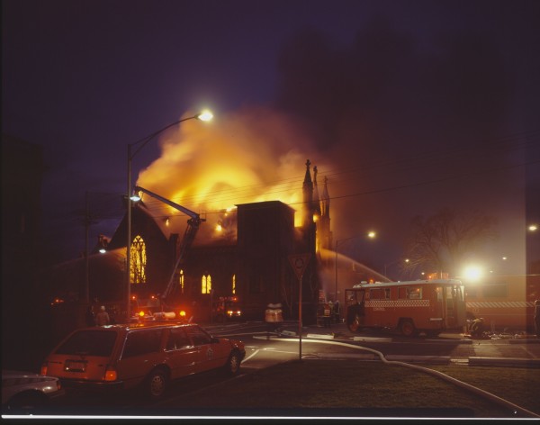
1988 Cairns Memorial Church fire
In the early evening of 15 August 1988 the Cairns Memorial Church caught fire. Professional photographer and resident of East Melbourne, Rod Goodwin was returning home from an assignment in the city when the fire was beginning to engulf this historic church. With his most suitabl...
Gallery image
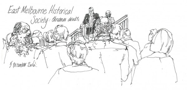
2016 Christmas Party - Alissa Duke
Subjects People Open full image ↗ Acknowledgments Drawn by Alissa Duke and published with permission. www.alissaduke.com for Etsy store and Weekly Art blog Facebook: Alissa Duke Art Instagram: alissaduke1 see all my art on http://www.flickr.com/photos/alissaduke Gallery People Ty...
Collection item
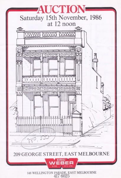
209 George Street, East Melbourne 209, Hepburn Terrace
Brochure advertising auction of 209 George Street, East Melbourne scheduled for 15 November 1986. Black and white sketch. Floorplan. The vendors were Anthony and Rae Ganim. The house sold for $380,000.
Collection item
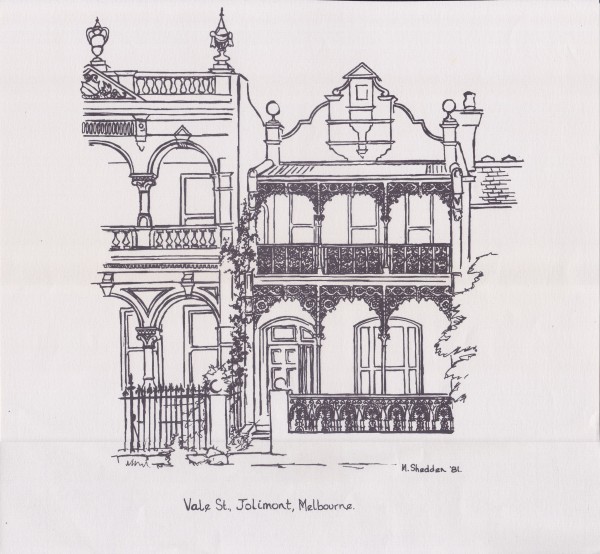
22 Vale Street, Jolimont
Line drawing of the house at 22 Vale Street South, 1981 by M Shedden.