Collection or topic
1864 (revised 1875) East Melbourne Map
In this collection
5 records and collections
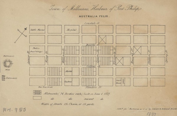
Map
1837 Town of Melbourne
1 of 14 next › last 1837 Town of Melbourne Open full image ↗ 1 of 14 next › last
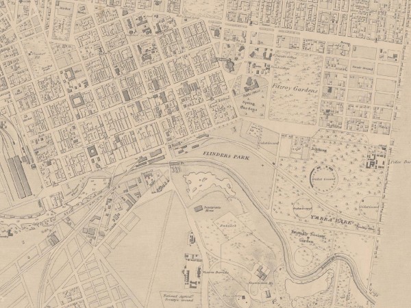
Map
1864 (revised 1875) East Melbourne Map
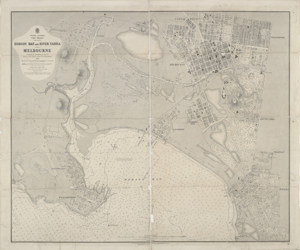
Extract of East Melbourne from British Admiralty Chart "Map of Hobson Bay and Yarra River leading to Melbourne" surveyed in 1864, first published 1865. This version has annotations dated 1875. See full chart under EMHS catalogue item emdf0041.
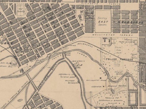
Map
1864c East Melbourne Map
first ‹ previous 3 of 14 next › last 1864c East Melbourne Map Open full image ↗ first ‹ previous 3 of 14 next › last
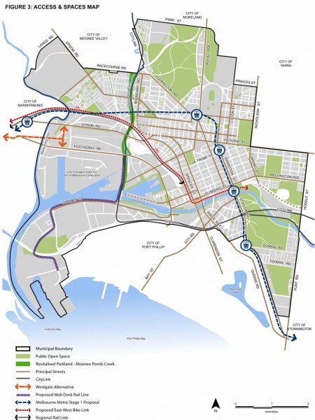
Map
2010 City of Melbourne MSS Figure 3 - Access and Spaces Map
Figure 3 from City of Melbourne Municipal Strategic Statement July 2010. Click on the Zoom and pan tab to see the detail.
Collection item
Map of Hobson Bay and Yarra River leading to Melbourne 1864
Chart of Hobson Bay and River Yarra leading to Melbourne surveyed by H.L. Cox ; assisted by Thos. Bourchier & P.H. McHugh, 1864 ; engraved by J. & C. Walker. Published 1865. This edition published 1866 but further annotated with survey information from 1875.