Map
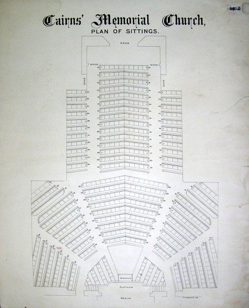
1884 28 Cairns Memorial Church seating plan 28-A
Uniting Church in Australia Synod Archives and Historical Society http://victas.uca.org.au/resources/synod-archives-and-historical-society
East Melbourne Historical Society
People, places and stories, connected.
52 results
Map
Uniting Church in Australia Synod Archives and Historical Society http://victas.uca.org.au/resources/synod-archives-and-historical-society
Map
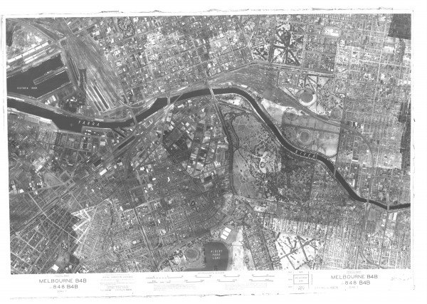
first ‹ previous 6 of 14 next › last 1945 Aerial Photo - Melbourne Open full image ↗ State Library of Victoria first ‹ previous 6 of 14 next › last
Map
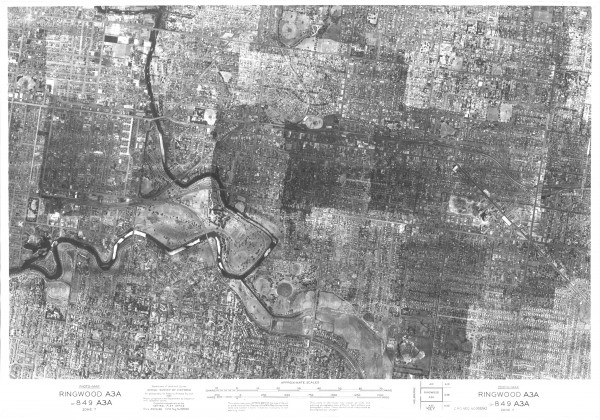
first ‹ previous 7 of 14 next › last 1945 Aerial Photo - Melbourne East Open full image ↗ State Library of Victoria first ‹ previous 7 of 14 next › last
Map
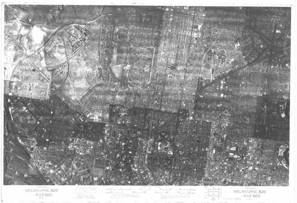
first ‹ previous 8 of 14 next › last 1945 Aerial Photo - Melbourne North Open full image ↗ Acknowledgments State Library of Victoria first ‹ previous 8 of 14 next › last
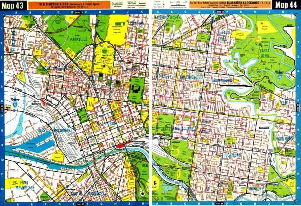
Map
first ‹ previous 9 of 14 next › last 1966 Melway Maps 043, 044 Open full image ↗ Acknowledgments Maps Collection, State Library of Victoria first ‹ previous 9 of 14 next › last
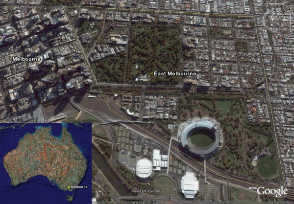
Map
first ‹ previous 10 of 14 next › last 2007 07 East Melbourne Google Earth Open full image ↗ first ‹ previous 10 of 14 next › last
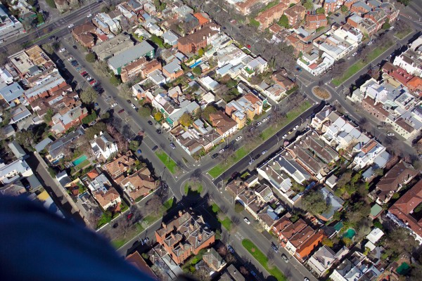
Map
first ‹ previous 11 of 14 next › last 2007 Aerial photo - Simpson & Hotham Streets Open full image ↗ Photographer: John Bragagnolo. first ‹ previous 11 of 14 next › last
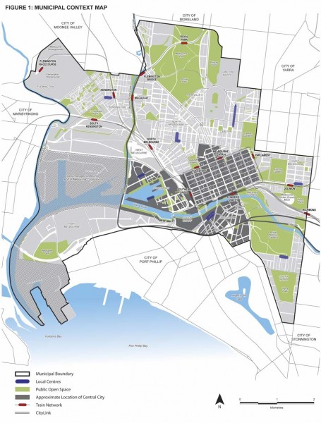
Map
Figure 1 from City of Melbourne Municipal Strategic Statement July 2010. Click on the Zoom and pan tab to see the detail.
Map
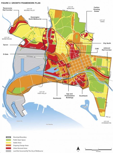
first ‹ previous 13 of 14 next › last 2010 City of Melbourne MSS Figure 2 - Growth Framework Open full image ↗ Figure 2 from City of Melbourne Municipal Strategic Statement July 2010. See EMHS Catalogue Item DF0009 Acknowledgments http://www.melbourne.vic.gov.au first ‹ previous...
Map
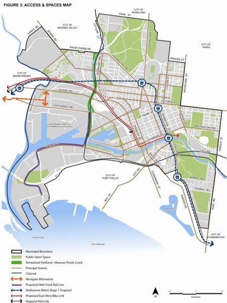
Figure 3 from City of Melbourne Municipal Strategic Statement July 2010. Click on the Zoom and pan tab to see the detail.
Map
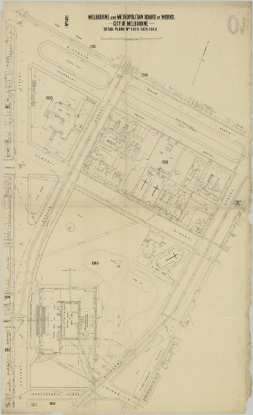
MMBW detailed plan of East Melbourne published in 1895 covering Victoria Parade North, Victoria Parade South, Gisborne Street, Parliament Place, Gipps Street (St Andrews Place), Carpentaria Place, Spring Street, Evelyn Street and Albert Street.
Map
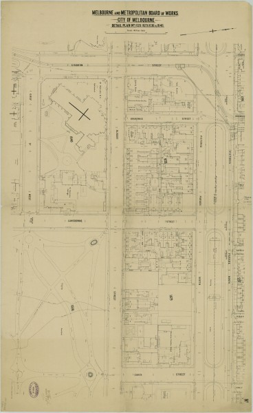
MMBW detailed plan of East Melbourne published in 1899 covering Gisborne Street, Victoria Parade, Cathedral Place (Grey Street), Albert Street, Brunswick Street, Lansdowne Street, Eades Street and Fitzroy Gardens.
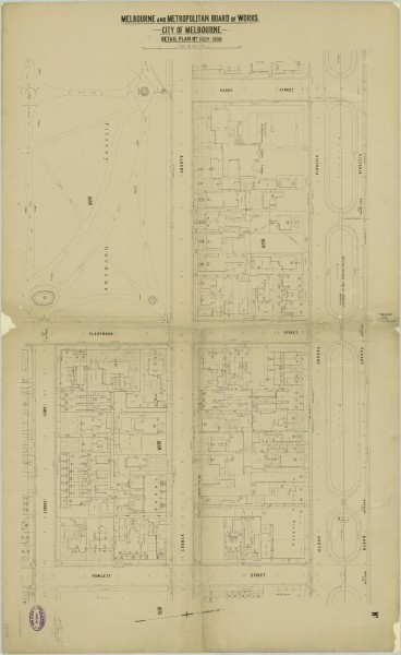
Map
MMBW detailed plan of East Melbourne published in 1899 covering Victoria Parade, Powlett Street, Grey Street, Clarendon Street, Albert Street, Eades Street and Fitzroy Gardens.
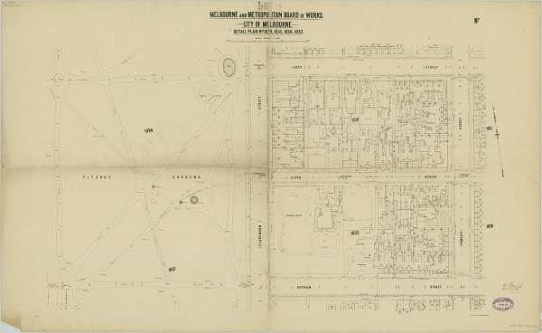
Map
MMBW detailed plan of East Melbourne published in 1899 covering Grey Street, Powlett Street, Hotham Street, Clarendon Street, Gipps Street and Fitzroy Gardens.
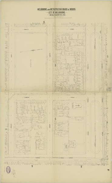
Map
MMBW detailed plan of East Melbourne published in 1899 covering Powlett Street, Victoria Parade, Hoddle Street, Grey Street, Albert Street and Simpson Street.
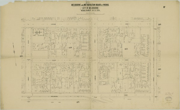
Map
MMBW detailed plan of East Melbourne published in 1898 covering Hotham Street, Hoddle Street, Wellington Parade, Powlett Street, Simpson Street and George Street.
Map
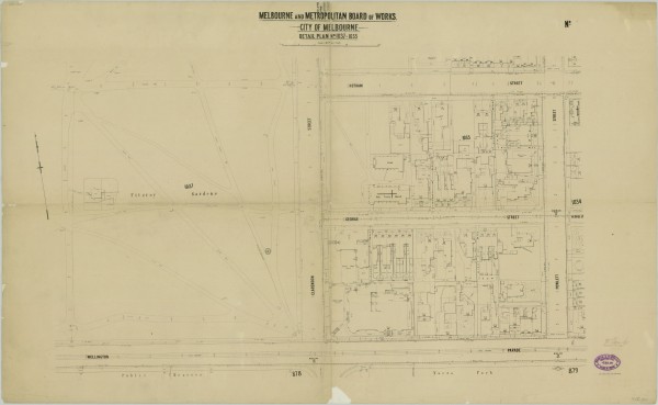
MMBW detailed plan of East Melbourne published in 1899 covering Hotham Street, Powlett Street, Wellington Parade, George Street, Clarendon Street and Fitzroy Gardens.
Map
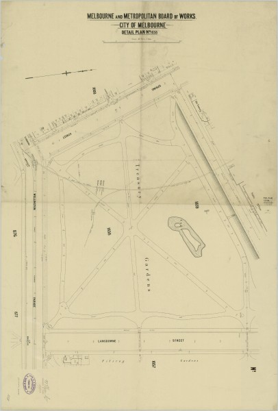
MMBW detailed plan of East Melbourne published in 1899 covering Treasury Place, Lansdowne Street, Wellington Parade, Flinders Street, Spring Street and Treasury Gardens.
Map
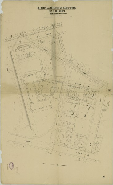
MMBW detailed plan of East Melbourne published in 1899 covering Spring Street, Carpentaria Place, Gisborne Street, Parliament Place, Grey Street (Cathedral Place), Lansdowne Street, Treasury Place and Gipps Street (St Andrews Place).
Map
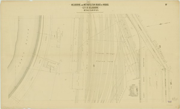
MMBW detailed plan of East Melbourne published in 1896 covering Flinders Street, Wellington Parade, Railway Yards, City Morgue, Corporation Baths and Yarra River.
Map
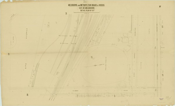
MMBW detailed plan of East Melbourne published in 1897 covering Wellington Parade, Jolimont Road, National Gymnasium, East Melbourne Cricket Ground, Princes Bridge Station Yard, Flinders Park.
Map
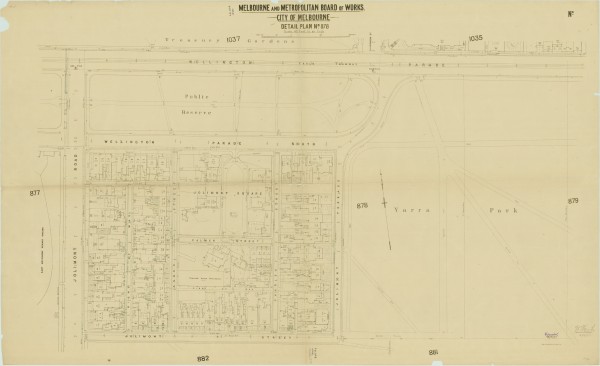
MMBW detailed plan of East Melbourne published in 1897 covering Jolimont Terrace, Jolimont Street, Jolimont Road, Wellington Parade, Wellington Parade South, Palmer Street, Agnes Street, Charles Street and Yarra Park.
Map
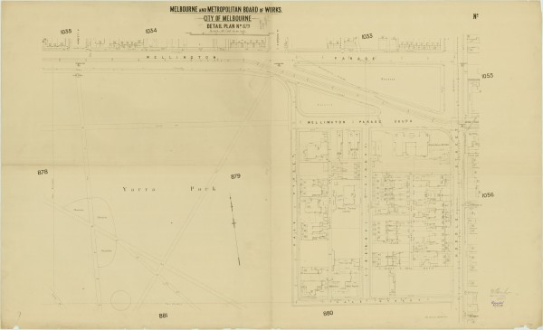
MMBW detailed plan of East Melbourne published in 1897 covering Hoddle Street (Punt Road), Wellington Parade, Wellington Parade South, Berry Street, Vale Street, Yarra Park.
Map
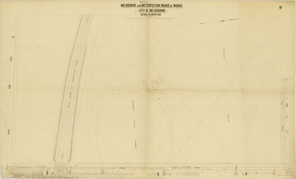
MMBW detailed plan of East Melbourne published in 1895 covering Yarra Park and the Richmond Cricket Ground.