People, places and stories, connected.
Collection item
17 Powlett Street, East Melbourne. Plans for proposed library
File of documents, correspondence and plans regarding proposed conversion of the house at 17 Powlett Street into a local library, with a seven storey apartment block attached at the rear. In return for the Council's acquisition of the house as a library the existing library block...
Collection item
171 Powlett Street
Auction brochures from 2008. Photos. Plan.
Collection item
171 Simpson Street
Documentation including auction brochure with photos and plan.
Collection item
172 Hotham Street
Sale brochure. Photocopy of article in The Australian Home Beautiful, May 1956, by Jane Cumming, the then owner, who describes the house and her renovations. Photos.
Collection item
173 George Street
Auction brochure.
Collection item
174 George Street
Brochures advertising auctions of apartments at 174 George Street. Photos. Plan.
Collection item
175 George Street
Newspaper clipping about sale of 175 George Street.
Collection item
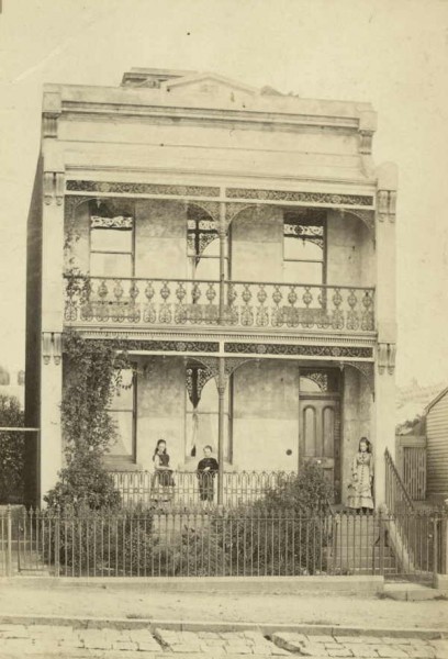
175 Powlett Street, East Melbourne - 1873c.
Photograph of 175 Powlett Street East Melbourne taken about 1873. At the time the house was the home of Henry Bunney and his family. The picture is described, "Viewed from road: Two storey terraced house, with wrought iron balcony and verandah rails, Henry Bunney's children Fred,...
Collection item
176 Wellington Parade, Certificate of Title
Certificate of Title for 176 Wellington Parade. Traces owners from Bland Holt in 1904 back to Joseph Richardson Tuckett in 1883.
Collection item
18 Berry Street
Brochure advertising auction of 18 Berry Street, East Melbourne, scheduled for 23 October 2004. Photos. Plans.
Collection item
18-30 Grey Street
Brochures and real estate clippings about units for sale at 18-30 Grey Street, from 2005.
Collection item
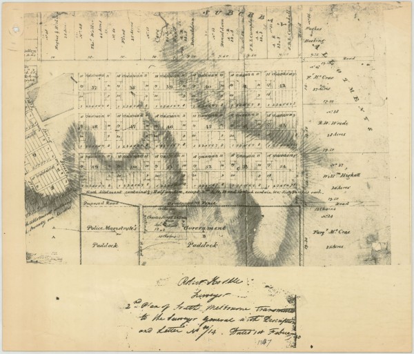
1837 East Melbourne Plan - Robert Hoddle
Part of Robert Hoddle's survey of South Melbourne completed in 1837 showing proposed roads and allotments. The location of La Trobe's house is shown but allotments are shown in the areas which later became Fitzroy Gardens and other public and church lands.
Collection item
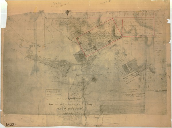
1837 Melbourne Plan - Robert Hoddle
Town of Melbourne, Plan of the Settlement of Port Phillip Includes planned allotments. Covers Melbourne, East Melbourne, South Melbourne, Yarra River and allotments along St Kilda Road.
Collection item
184 George Street
Newspaper articles on renovations at 184 George Street. Work on the facade won an Australian Institute of Architects award in the Heritage section. The Age, 2 and 24 July 2011, Domain
Collection item
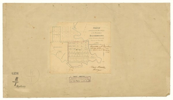
1843 Plan of Richmond by Robert Hoddle
The map shows Collingwood and Richmond subdivided into allotments. The Richmond allotments are inscribed with the names of the original purchasers. To the west of Richmond the part of East Melbourne south of Wellington Parade is shown. It is called Melbourne here as it was land t...
Collection item
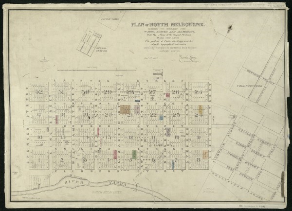
1847 Plan of North Melbourne by Charles Laing
The map shows the city of Melbourne with names of orginal purchasers marked. Public buildings are also marked. The western edge of the proposed East Melbourne is shown with streets marked with a set of names very different from the eventual names used. The map is in the collectio...
Collection item
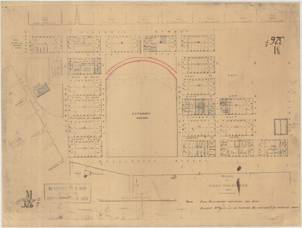
1848 East Melbourne Plan
Plan of East Melbourne 1848 Includes: Legislative Assembly on Spring Street opposite Bourke Street; Fitzroy Square (so named) showing some contemporary markings and plans, but not Treasury Gardens or Government Offices; Gisbourne Street running due north from Flinders Street to V...
Collection item
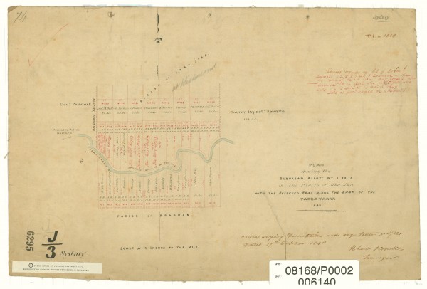
1848 Plan of Parish of Jika Jika
The map shows Richmond subdivided into allotments with names of first purchasers inscribed. To the west of Richmond lies the as yet undeveloped East Melbourne, south of Wellington Parade. The edge of the Government Paddock is shown. To the south-west of the paddock an arrow point...
Collection item
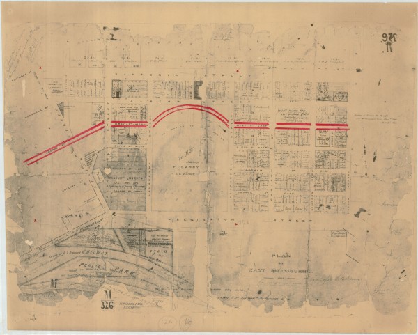
1850 East Melbourne Plan with later amendments
Plan of East Melbourne labelled 1850 but with various amendments dated 1862, 1863, 1864 and 1865 Significantly reworked from the 1848 plan. Includes: An extension of Bourke Street cutting through what was previously shown as the Legislative Assembly building to join up with Gisbo...
Collection item
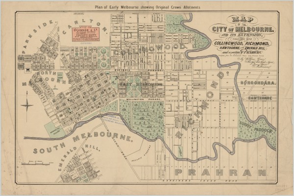
1852 Map of the City of Melbourne and its Extension - William Green
A map issued by O'Connor & Co., Land Agents. It is a copy of the original map drawn by William Green, surveyor, architect and land agent, in 1852 and released in December that year. The map covers the City of Melbourne and inner suburbs. It probably dates from the 1920s as by the...
Collection item
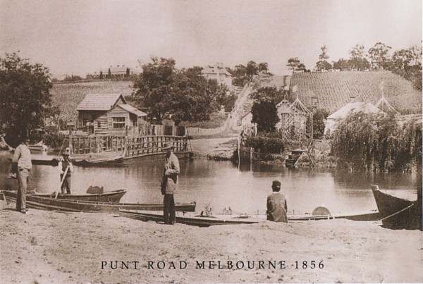
1856 - The punt at Punt Road
A photograph of the punt at Punt Road Richmond taken in 1856. The punt for horses and carriages is on the far (south) bank. There are several small punts for pedestrians on the north bank awaiting business. On the south side of the river Punt Road rises sharply with cultivated la...
Collection item
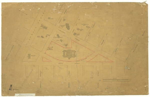
1856 Plan of Eastern Hill
Map shows Eastern Hill marked with churches and public buildings. The map shows some buildings which have been all but forgotten such as the Police Barracks, the Reservoir and Apsley Place. The original map is in the collection of the Public Record Office of Victoria, in its Hist...
Collection item
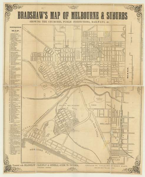
1857 Bradshaw's map of Melbourne & suburbs
A map of Melbourne and suburbs, with streets named and churches and public institutions marked. The original map is in the collection of the State Library of Victoria and its record reads as follows: Title: Bradshaw's map of Melbourne & suburbs [cartographic material] : showing t...
Collection item
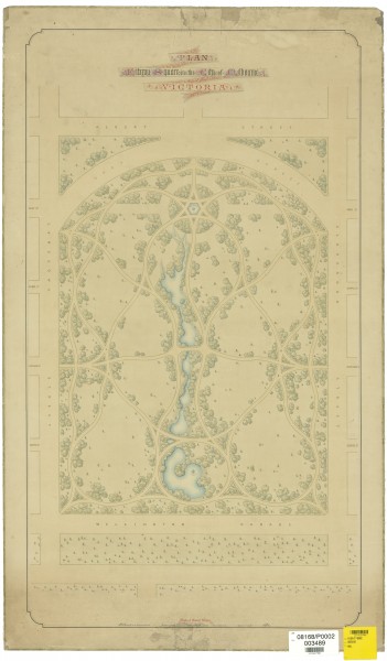
1857 Design for Fitzroy Square by E L Bateman
A plan showing the proposed design for the laying out of the Fitzroy Gardens by Edward La Trobe Bateman. The plan was commissioned by the City of Melbourne. The Age of 1 Jun 1858 reported on a Council meeting the previous day in which it was agreed, after some debate, to pay Bate...